Europe is currently suffering a deep political and economic crisis following years of turmoil and austerity measures that have disproportionately and brutally hit the most disadvantaged regions and citizens across most of the continent. At the same time, there has been a revival of nationalisms and divisions in this part of the world that, a decade ago, seemed to be united in diversity and moving towards ever-closer union. Concentrated poverty near to riches and profound spatial inequality have long been persistent features of all European countries, with disparities often being most stark within the most affluent cities and regions, such as London. In other parts of Europe levels of inequality and poverty have been reducing and are often much lower. However, the severe economic crisis and austerity measures have led, in many cases, to an enhancement of existing disparities. The following eight maps show how the regional geography has changed in the light of these developments:
GDP

(click for larger version)
Change in GDP

(click for larger version)
Household Income

(click for larger version)
Change in Household Income

(click for larger version)
Unemployment

(click for larger version)
Change in Unemployment

(click for larger version)
Poverty Risk

(click for larger version)
Tertiary Education

(click for larger version)
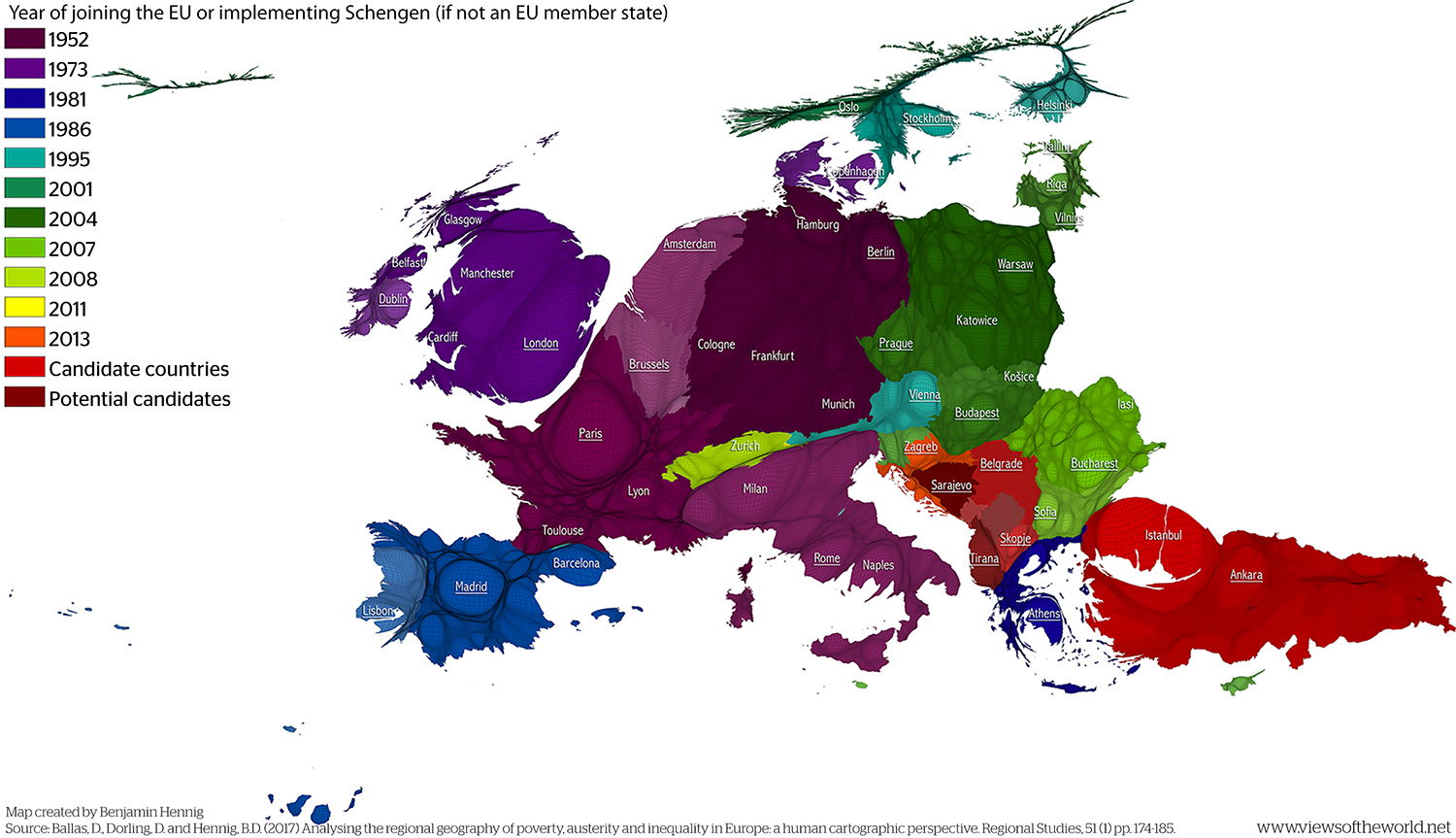
These maps are using a gridded cartogram as base. This equal-population projection shows each area in the map resized according to the total number of people living in that area. The following reference map helps to orient in this map by including some key labels for cities across the continent. It also highlights the year that each country was affiliated with the European Union by either becoming a member state or by signing up to the Schengen free travel area (when not an EU member state). Candidate countries as well as potential candidates are also included in this map:
All these maps are taken from a paper that I worked on with Dimitris Ballas and Danny Dorling. In the paper we present a human cartographic approach to the analysis of the impact of austerity and the economic crisis across the regions of Europe. In the paper we reflects on past insights and debates on the analysis and mapping of poverty and wealth and of the effects of austerity in particular. Using a wide range of cartograms and maps including the subjects of unemployment and poverty as well as related themes such as educational attainment and migration we highlight social and spatial inequalities and also illustrate that the most severe social divides within Europe are more often within states rather than between them. This leads us to argue for a coordination of urban, regional, national and European policies and EU spending to ameliorate the impacts of austerity and to enhance social and territorial cohesion. Our paper also highlights the increasingly important role of geographers and of the field of Regional Studies in many recent debates about the future of the European Union as a Europe of regions rather than a Europe of nation-states.
Here are the full publication details:
- Ballas, D., Dorling, D. and Hennig, B.D. (2017) Analysing the regional geography of poverty, austerity and inequality in Europe: a human cartographic perspective. Regional Studies, 51 (1) pp. 174-185.
Article online (Taylor & Francis)
This paper is also part of another book project, the Human Atlas of Europe, which was published recently (US edition coming soon with University of Chicago Press):
- Ballas, D., Dorling, D. and Hennig, B.D. (2017) The human atlas of Europe. Bristol (Policy Press).
Order book (Policy Press)
The content on this page has been created by Benjamin Hennig in collaboration with Dimitris Ballas and Danny Dorling. Please contact me for further details and the terms of use.

